Coba
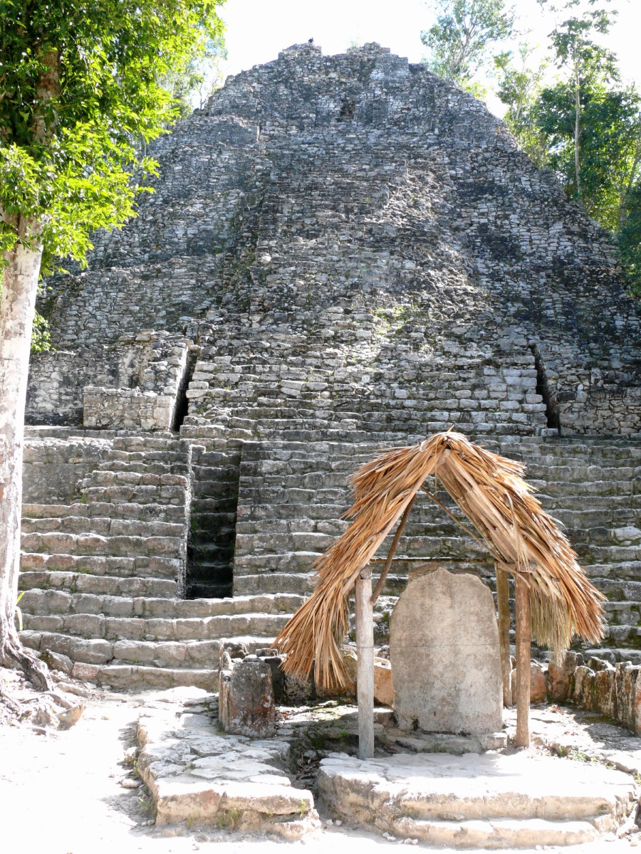
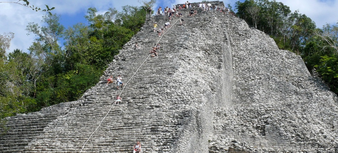
“Water stirred by wind.” Place of the “Nohoch Mul Pyramid”, the tallest pyramid on the Yucatan peninsula with 42 meters and 130 steps up to the top of the site. From the top of Coba’s ancient pyramid, the jungle looks like a living green carpet. The ruins of Coba lie 44 km northwest of Tulum, in the State of Quintana Roo, Mexico. 172 km from Cancun, enveloped in the deep green of the tropical jungle, this ancient Mayan city rises up between two lagoons. In its era of splendour the…
"Wasser vom Wind gerührt." Ort der „Nohoch Mul Pyramide“, der höchsten Pyramide auf der Halbinsel Yucatan mit 42 Metern und 130 Stufen bis zur Spitze des Geländes. Von der Spitze der alten Pyramide von Coba aus sieht der Dschungel aus wie ein lebender grüner Teppich.
Die Ruinen von Coba liegen 44 km nordwestlich von Tulum im mexikanischen Bundesstaat Quintana Roo. 172 km von Cancun entfernt, umgeben von dem tiefen Grün des tropischen Dschungels, erhebt sich diese alte Maya-Stadt zwischen zwei Lagunen. In seiner Glanzzeit erstreckte sich das Gelände über 75 km².
Coba hatte auf seinem Höhepunkt schätzungsweise mehr als 50.000 Einwohner, wurde zuerst um 100 v. Chr. Bewohnt und schließlich aufgegeben, als die Spanier um 1550 die Halbinsel eroberten. Die Stadt war jedoch einst die mächtigste in der Region und kontrollierte Ackerland, Handelswege und wichtige Wasserquellen.
Die Stätte ist der Nexus des größten Netzwerks von steinernen Dammwegen der antiken Maya-Welt und enthält viele gravierte und skulptierte Stelen, die das zeremonielle Leben und wichtige Ereignisse der spätklassischen Periode der mesoamerikanischen Zivilisation dokumentieren. Einige dieser Darstellungen zeigen Frauen Stadt hatte viele weibliche Herrscher. Es gibt auch zwei gut erhaltene Ballplätze auf dem Gelände, auf denen ōllamaliztli, ein traditionelles Maya-Ballspiel, gespielt wird. Coba war eine wichtige Handelsverbindung zwischen der Karibikküste und den Städten im Landesinneren, ein Netz alter Straßen namens Sacbe in Maya, was bedeutet, dass von Coba eine „weiße Straße“ ausgeht.
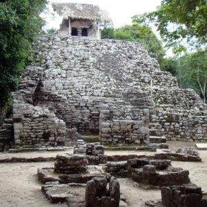
Die wichtigen Artefakte und Strukturen, die in den Ruinen von Coba besichtigt und erlebt werden können:
![]() Nohoch Mul Pyramid.
Nohoch Mul Pyramid.
![]() Pyramid of the Painted Lintel.
Pyramid of the Painted Lintel.
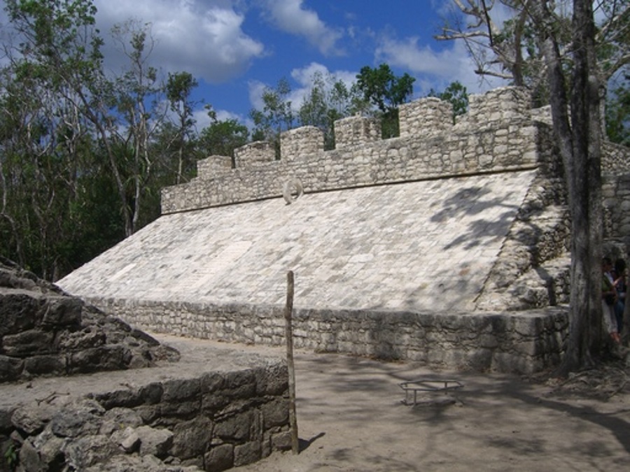
![]() Macanxoc Group.
Macanxoc Group.
![]() Coba Stelaes.
Coba Stelaes.
![]() Joined Roads.
Joined Roads.
Information
-
AbfahrtCancun / Riviera Maya
Bildergalerie
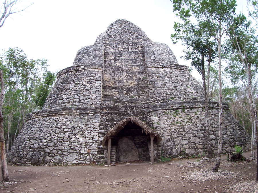
Nohoch Mul Pyramid
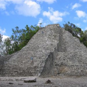 The tallest pyramid on the Yucatan Península with 42 meters and 130 steps up to the top of the site. From the top of Coba’s ancient pyramid, the jungle looks like a living green carpet.
Open for the public to climb | With 42 meter long
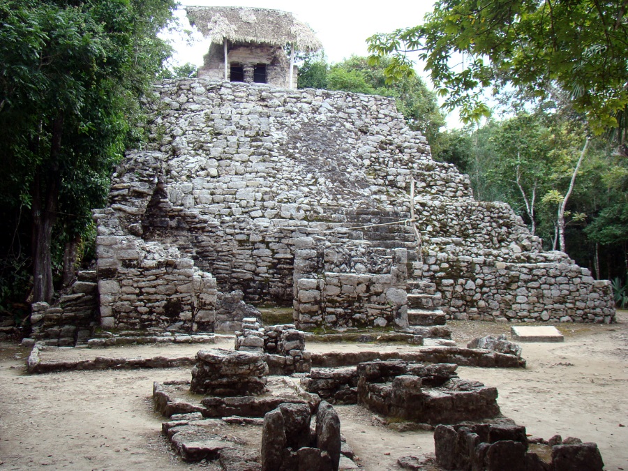
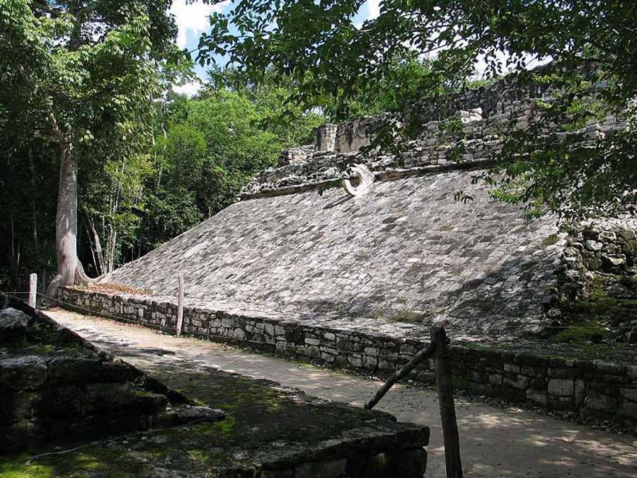
Pyramid of the Painted Lintel
 This group of buildings mostly corresponds to the last period of occupation in Coba. Building I has a temple on its upper part whose frieze and lintel were richly painted on their interior side, as well as with a stele. This group of buildings belongs to the last period of occupation of the city of Coba. Its architectual style pertains to what is called the east coast style, which corresponds to the Post-Classic period.
Part of the Painting Complext
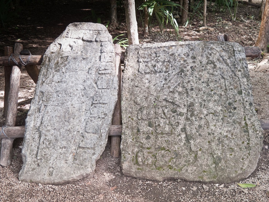
Coba Stelaes
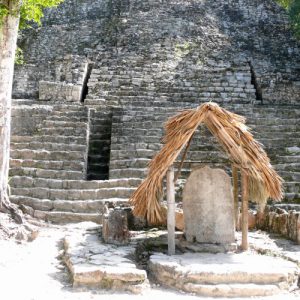 These monuments give insight into various aspects of the formal life of Coba. The hieroglyphic inscriptions contain additional information about the city’s sociopolitical organization as well as dates and accounts of major historical events, including dress, ritual processes, and the roles and power of both men and women in the city’s ceremonial and political activities. Women are the figures of authority in many of the scenes depicted on the stelae.
Carved in the 7th century | Part of the Macanxoc Group
Joined Roads
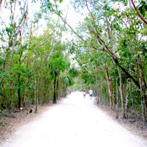 Unique to this Mayan city. These roads range in width from 10 to 30 feet and were built by the Maya for commerce. The longest is 62/100 kilometers; most transportation along sacbes was done in the cool temperatures of night. The white limestone provided a natural guide when illuminated by moonlight.
The longest Sacbe Road is 62 km/100 km
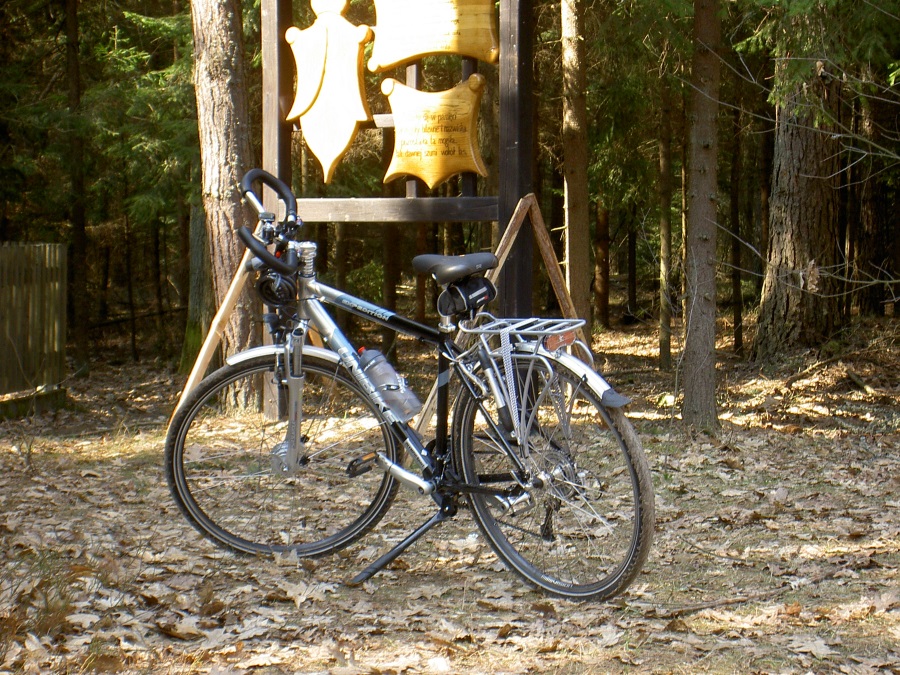
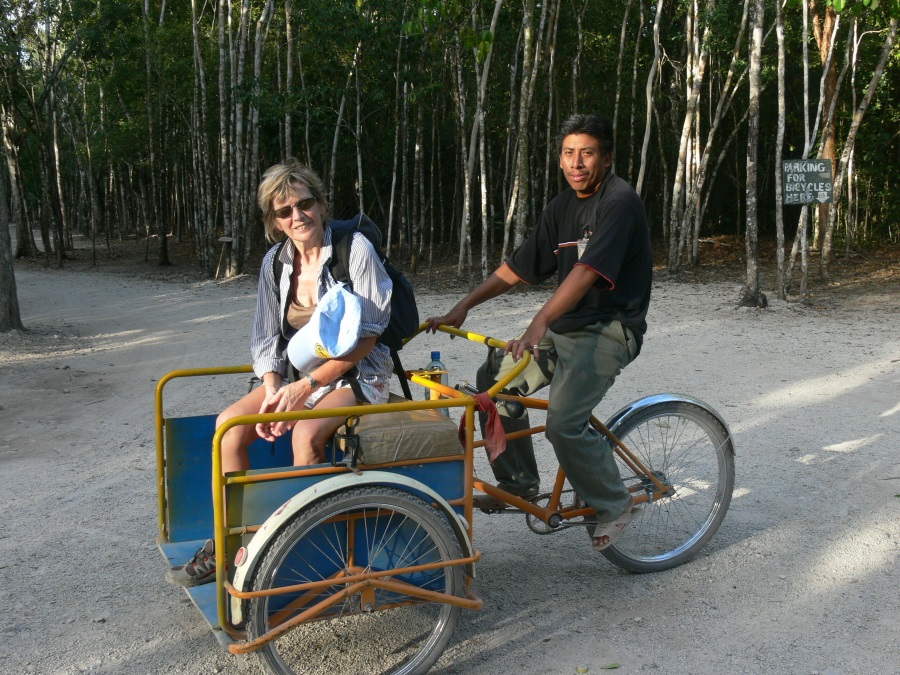
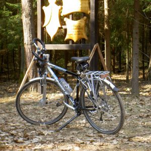
Bicycle Expedition
 Wander the Sacbe Roads in a bici taxi or in a bicycle and marvel yourself with the green Mayan forest. From the entrance to the Nohoch Mul Pyramid is about 2 km of distance, the other principal buildings of Coba Ruins are also about 2-3 km of distance between one another.
Rent a bici taxi or a bicycle on site. Round about 10 km.
Tour Location
Coba, Mexico
Our Gallery